

This post is also available in:
 Italiano (Italian)
How is the Perito Moreno glacier
The Perito Moreno Glacier is a glacier located in the Los Glaciares National Park in southwest Santa Cruz Province, Argentina. It is one of the most important tourist attractions in the Argentinian Patagonia . The 250 km2 (97 sq mi) ice formation, and 30 km (19 mi) in length, is one of 48 glaciers fed by the Southern Patagonian Ice Field located in the Andes system shared with Chile. This ice field is the world’s third largest reserve of fresh water.
Because this name
The Perito Moreno Glacier, located 78 kilometres (48 mi) from El Calafate, was named after the explorer Francisco Moreno, a pioneer who studied the region in the 19th century . Played a major role in defending the territory of Argentina in the conflict surrounding the international border dispute with Chile . You can get to El Calafate, Argentina, departing from Puerto Natales, Chile. The bus ride takes about four hours. The border control can take a long time.
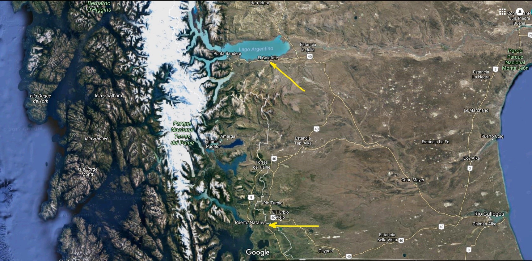
The tow arrows indicate Puerto Natales , Chile , and El Calafate in Argentina. Travel between Chile and Argentina was made by bus through the Patagonia , vast stretches without houses , windswept , arid and dry . The only inhabitants were the sheep and wildlife . The lands are owned by a few families of wealthy ranchers who live isolated in their farms , the name in spanish is Estancia
Its size
The glacier is unusual in that it is advancing, while most glaciers worldwide are retreating , the reason remains debated by glaciologists. The terminus of the Perito Moreno Glacier is 5 kilometres (3 mi) wide, with an average height of 74 m (240 ft) above the surface of the water of Argentino Lake, in Argentina. It has a total ice depth of 170 metres (558 ft).

Aerial view of the Perito Moreno glacier . The arrow indicates the stroke where the glacier growing blocks communication betweeen the Lake Argentino in right and left arm Rico
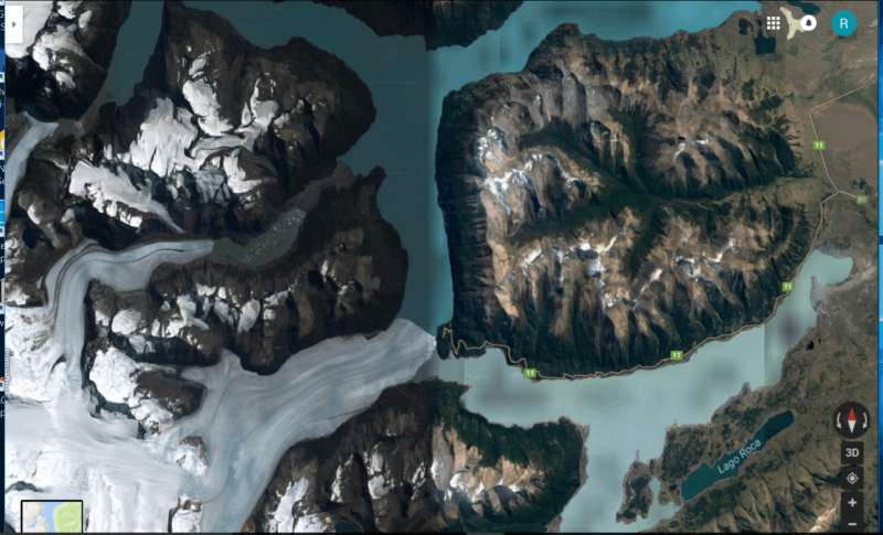
The same map as the previous. Lake Rico is down and the Argentino Lake above the Perito Moreno glacier
The spectacular breakup
Pressures from the weight of the ice slowly pushes the glacier over the southern arm (“Brazo Rico”) of Argentino Lake, damming the section and separating it from the rest of the lake. With no outlet, the water level on the “Brazo Rico” side of the lake can rise by as much as 30 meters above the level of the main body of Argentino Lake. Intermittently, the pressure produced by the height of the dammed water breaks through the ice barrier causing a spectacular rupture, sending a massive outpouring of water from the Brazo Rico section to the main body of Lake Argentino. As the water exits Brazo Rico, the scored shoreline is exposed, showing evidence of the height of the water build-up. This dam–ice-bridge–rupture cycle recurs naturally between once a year to less than once a decade. From Wikipedia, the free encyclopedia
The PDF and Power Point presentations
You can choose to use a Power Point presentation or if you can’t with PP you can open the presentation in PDF. The presentation is full of beautiful pictures and captions.

This post is also available in:
Italiano (Italian)